
The earth is surrounded by a magnetic field that is generated in the earth’s core, this is the field that magnetic compasses align with to indicate the direction to the north and south magnetic poles. Close to the earth’s surface and within the earth this magnetic field is interfered with by the magnetism of bodies of rock that contain differing amounts of magnetic minerals, the magnetic fields from these rock bodies have various strengths and combine with the magnetic field generated in the earth’s core either increasing or decreasing the strength of the resulting field strength depending on the orientation of the magnetic body of rock and its magnetic field relative to the magnetic field generated by the earth’s core, this results in localised differences or fluctuations in the strength of the resultant magnetic field close to the earth’s surface.
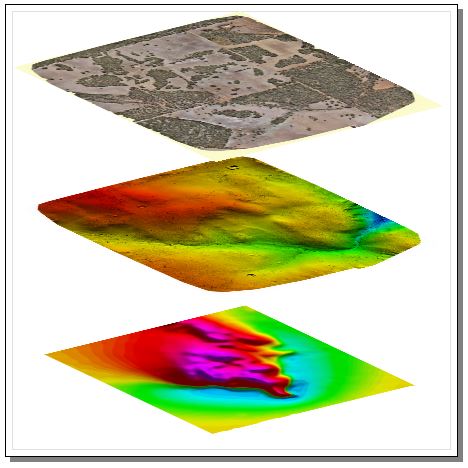
If the strength of the magnetic field near to the earth’s surface is measured using a magnetometer and the measurements are then plotted in their relative positions and contoured in an image the patterns of measured low and high magnetic field strength in the image will reflect the position, shape and size, and magnetic properties of the rock bodies and structures within the earth’s crust.
Historically this has been done using ground magnetic survey methods, with operators either on foot or using quad bikes to traverse pre-planned survey lines on the ground taking magnetic measurements using a handheld magnetometer and a GPS to locate the measurements, or by airborne magnetic survey methods, flying pre-planned survey lines with a fixed wing aircraft or helicopter fitted with a magnetometer measuring and recording the measurements with their respective GPS positions.
These methods have inherent problems, ground magnetics is slow and expensive to acquire and while being the highest resolution when acquired the magnetic data is almost always very noisy due to taking the magnetic measurements very close to surficial magnetic material and has to be heavily filtered, this surficial noise and filtering destroys the fine scale or subtle geological response in the data. Airborne magnetic data has far less noise than ground collected magnetic data, but, depending on the topography it can be very difficult to follow the terrain correctly and keep the aircraft at a constant height above the ground using a fixed wing aircaft, this results in artificial variations in the measured field strength due to the height variations as well as partial or complete loss of fine scale and subtle magnetic response when the aircraft is forced to fly higher above the ground due to steep or difficult terrain.
A helicopter with a magnetometer mounted on a boom or stinger can be used to fly difficult terrain better than a fixed wing but the magnetic data from a stinger mounted magnetometer is notoriously noisy due to the close proximity of the magnetic sensor to the rotating metallic components and electronics of the helicopter. As well as the inherent data quality issues with conventional airborne surveys there is also a large element of danger with the safety of the pilot (and system operator if onboard) and the large asset value of the aircraft at high risk when flying very low levels, each survey demands an exhaustive risk assessment before commencing, and even then numerous aircraft and lives have been lost over the years.
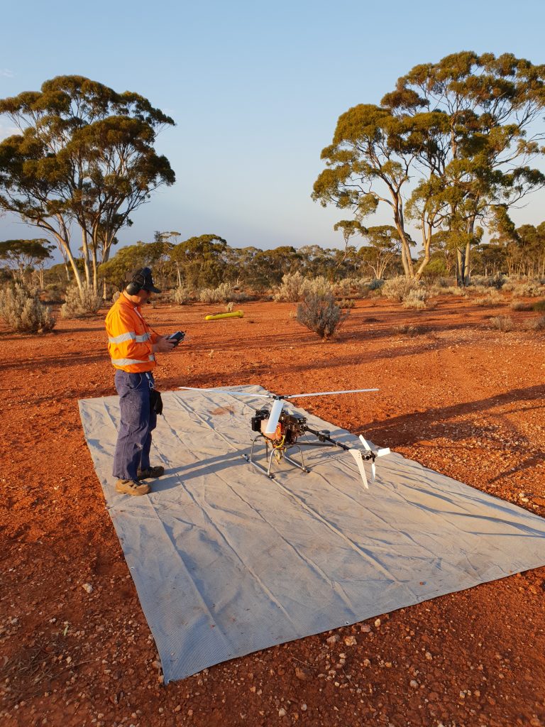
A UAV mounted system solves the problems above, particularly if the magnetometer is housed in a towed bird that flies at a distance below the UAV and its engine and electronics reducing or eliminating any aircraft induced noise in the data. A rotary wing UAV can fly with practically zero risk to human safety, at a constant height above the ground and can follow the terrain regardless of the topography, the height of the tree canopy and any structures in the survey area being the only constraint with regards to minimum sensor height. Using a UAV and towed magnetometer bird to collect magnetic data allows magnetic data resolutions at close to ground survey resolutions, without the inherent safety, noise, or terrain following issues inherent to ground or conventional airborne surveys.
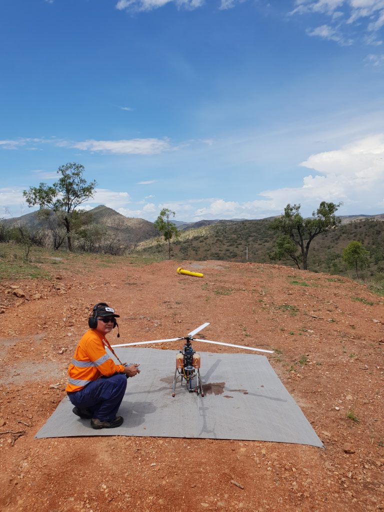
Pegasus Airborne System’s autonomous single rotor UAV and underslung TB-03 magnetometre system produces ultra-high resolution and ultra-high quality airborne magnetic survey data, quickly and safely.
In order to optimise the quality of the data that we acquire, process, and deliver to our clients we constantly strive to improve our aircraft, our automated flight systems and the integration of our data aquisition systems and sensor payloads.
During acquisition in the field we implement a strict quality control regime which monitors deviation from lateral and vertical guidance and magnetic noise levels, if for some reason any of these are found to be less than optimum the reason for this is investigated and resolved, and the affected lines are re-flown.
The raw data is then carefully processed by our experienced team of geophysicists and provided with a full suite of deliverables at no extra cost including final database report, located ASCII, with grids and located images, along with a detailed processing report and survey logistics report.
38/507 Walter Rd E,
Morley WA 6062
9:00 AM – 5:00 PM
Monday – Friday
Phone: (08) 6278 2898
Email: info@pegair.com.au